Ericeira is located 50km (31 miles) northwest of Lisbon and 25km (15.5 miles) from Sintra. There are no trains passing through town, but there are regular buses from Lisbon. The bus station is on Rua Alto da Camacha, within walking distance of the heart of town.
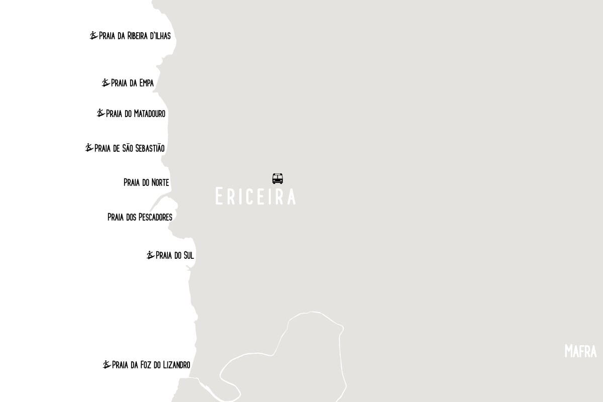
The map above shows the beaches of Ericeira, from north to south. The most central beach is Praia do Norte, which is a short walk from Praia de São Sebastião.
From Praia de São Sebastião it’s about a 10-minute walk up to Praia do Matadouro, which is right by the road, then another 12 minutes until you reach the sand of Praia da Empa, and 15 more minutes from there to the famous surfing beach of Ribeira d’Ilhas.
If you decide to walk south from Praia de São Sebastião, it’s less than 10 minutes to Praia do Norte, and also less than 10 minutes from there to Praia dos Pescadores. To get to the popular Praia do Sul, continue walking through the old town for another 10 minutes. The beach further to the south, the large Foz do Lizandro, is a 35-minute walk from Praia do Sul, following the coastal road.
Click on the map for a closer view of the town and its streets on Google Maps.